Danna Esther Gelfand
Danna Esther Gelfand
AP Human Geography 🚜
320 resourcesSee Units
Key Concepts
Culture
A cultural landscape is made up of structures within the physical landscape caused by human imprint/human activities. Ex: buildings, artwork, Protestant churches in the US South - Cathedrals in Southern/western Europe, mosques in Southwest Asia.
Cultural ecology is the study of how the natural environment can influence a cultural group.
Sequent occupancy is the theory that a place can be occupied by multiple different groups each modifying the landscape and having its own imprint for future occupiers Ex: Bolivia’s cultural landscape includes imprints/ influences from early Inca civilization and Spanish colonial conquerors.
Adaptive strategy is the way humans adapt to the physical and cultural landscape they are living in.
A symbolic landscape has significant meaning beyond its appearance due to cultural associations and interpretations. The Temple Mount in Jerusalem holds religious significance for Judaism, Islam, and Christianity, in addition to holding the remains of the ancient Jewish temple and a medieval Islamic mosque. The Temple Mount holds symbolic meaning and is more than just a part of an old city, which makes it a symbolic landscape.
Regions
Perceptual/Vernacular Regions are defined by certain cultural traits that people perceive them as that develop through books, media images, and historical and cultural differences between regions. (bible belt, Chinatown).
Formal Regions are areas inhabited by people who have one or more characteristics in common such as dialect, local cuisine, local activities, etc.(french speaking region of Canada).
Functional regions are areas organized to function politically, socially, and economically as a single unit. Radio broadcasts local culture, and sports teams bring people together. (Metropolitan area of Chicago, Bank of America).
Toponyms are places that reflect cultural identity in a specific cultural landscape. The names of certain toponyms can reflect past origins such as Santa Barbara (Santa-saint).
Gender
Traditional gender roles are being challenged by popular culture as patriarchy slowly decreases and feministic ideas develop.
The gender gap refers to differences in socioeconomic and political power and opportunity between men and women.
High maternal mortality (death rates of women that give birth) rates are present in LDCs (less developed countries) that are more impoverished.
High female infanticide rates (murder of female infants) occur in regions where families prefer male children to pass down family names and ideals.
Dowry deaths are even present today in regions such as India (however much less frequent than in the past) where a husband's family murders the bride due to her father not paying marriage money (dowry) to the husband's family.
Women's suffrage (the ability to vote) was not given until the 20th century in most countries. However, in such regions, today disenfranchisement is still present among women. Men outnumber women in areas that are highly populated such as India and China (gender imbalance).
State and Ethnicity
Centripetal forces unify a state and provide stability.
Centrifugal forces divide a state leading to balkanization, weakening, etc.
Cultural shatter-belt is the process where a state breaks down through Ethnic Conflict (balkanization).
A barrio is a Spanish-speaking neighborhood.
Ethnic cleansing is where the more powerful ethnic group forcibly removes the less powerful ethnic group to make a homogenous nation-state.
- Ex: WWII in which millions of Jews, Romas, and other ethnicities were forcibly moved to concentration camps and were later exterminated.
Balkanization is the process by which a state breaks down due to conflicts among its ethnicities. Ex: Yugoslavia which was once multicultural with multiple ethnicities broke up into 6 republics.
Land survey methods for portioning land to occupants differ by group ethnicity in the US and Canada. Land survey methods for parceling out land to its occupied Folk customs are decreasing due to pop cultural customs.
Land Survey Systems List
- Rectangular survey system/Public Land Survey system- divides land into a series of rectangular parcels used by the U.S. to parcel land west of the Appalachian mountains.
- Long-lot survey system-land is divided into narrow parcels stretching from rivers, roads, or canals. Spanish colonists adopted it and found a French charter group in Mississippi and St. Lawrence River valleys, Canadian Maritimes, parts of Quebec, Louisiana, and Texas land.
- Township and Range system- A rectangular land division scheme designed by Thomas Jefferson to disperse settlers evenly across farmlands of the U.S. interior.
- Metes and bounds system- relies on descriptions of land ownership and natural features such as streams or trees marked land boundaries. surveying east of the Appalachian Mountains.

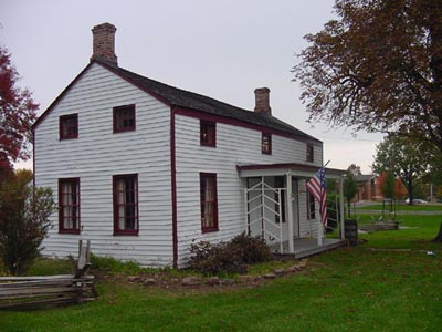
US Folk Housing Styles (see below)
- Middle Atlantic
- Lower Chesapeake/Tidewater
- New England

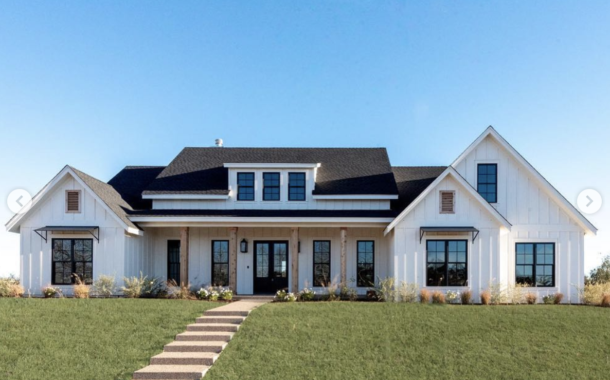
US Popular Housing Styles (widely spread, constantly changing, lack regional distinctiveness) (see below)
- Mass-produced
- Modern Style post WW2 (1945)
- Neo Eclectic since the 1960s

🎥 Watch: AP HUG - Cultural Landscapes
Browse Study Guides By Unit
🗺Unit 1 – Thinking Geographically
👪Unit 2 – Population & Migration
🕌Unit 3 – Cultural Geography
🗳Unit 4 – Political Geography
👨🌾Unit 5 – Agriculture & Rural Land-Use
🌇Unit 6 – Cities & Urban Land-Use
💸Unit 7 – Industrial & Economic Development
🧐Exam Skills
📚Study Tools

© 2024 Fiveable Inc. All rights reserved.